Polk State receives map from Southeastern Geological Society as part of Maps in Schools Project
Polk State College’s Earth Science Program received a geological map of time and terrain from the Southeastern Geological Society, giving Earth Science students and faculty an insightful, colorful view of how the United States formed.
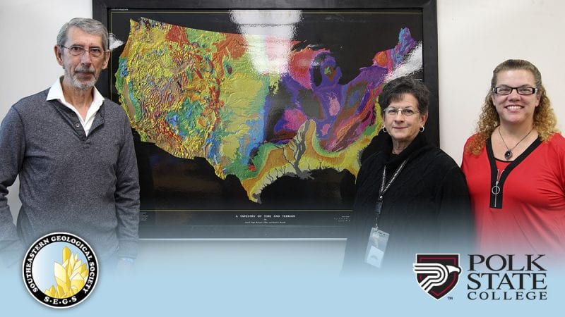
Southeastern Geological Society member, biologist, and “honorary geologist” Charles Cook, presented the map to professors KT Moran and Natalie Whitcomb with an audience that included Provost Stephen Hull, Academic Dean April Robinson, Assistant Academic Dean Kim Thomas, and Earth Science students.
“The Southeastern Geological Society began participating in the Maps in Schools Project in 2006 to educate Florida students about the ages of rocks and how the Earth came to be over time,” Cook explained. “This allows us to understand the future based on the theory of uniformitarianism.”
Through a scale of colors created from data through Geographic Information Systems (GIS), the map shows the oldest formations in red, such as the rock in north Minnesota, the youngest formations in yellow, such as the Florida peninsula, and everything in between. The visual aims to encourage interest and curiosity in science and geology.
“This map is a great addition to Polk State’s Earth Science courses by giving a stimulating visual of how the continent is put together. This is a valuable asset for our students.”
The Maps in Schools Project is sponsored by the U.S. Geological Survey, Gulf Coast Association of Geological Societies, and the Corpus Christi Geological Society. The Southeastern Geological Society’s participation in the program supports the society’s mission of “to advance geosciences knowledge of our members and communities.”
The maps are laminated and framed through volunteer efforts and are delivered as gifts to science classrooms across Florida. The donation also includes access to a national database that allows students to share information about local geology and learn about other areas of the country. The program has donated more than 1,000 maps since its inception.
“For some schools, this program is the first connection to the Southeastern Geological Society,” Cook said.
But that’s not the case for Polk State, which has enjoyed a longstanding partnership with the society that has proven beneficial for both students and faculty.
Moran and Whitcomb are members of a handful of Southeastern Geological Society committees. Moran is a member of the field trip and website committees, and Whitcomb is a member of the field trip and student awards committees. Both Polk State Faculty members attend several SEGS field trips every year.
They encourage students to become members of the society, which offers scholarship and extracurricular opportunities.
“The Southeastern Geological Society does a phenomenal job generating interest in the study of geology,” Moran said. “I can already see the variety of activities we will be able to do in our classes with this map.”
Whitcomb echoed a similar sentiment.
“This map is a great addition to Polk State’s Earth Science courses by giving a stimulating visual of how the continent is put together,” Whitcomb said. “This is a valuable asset for our students.”